Susquehanna Valley Orienteering
Beginners' Guide: The Map
Here is an orienteering map. The red or purple circles with the numbers are the controls. At each control, in the center of the circle, there is a mapped feature that you must find. This can be something such as a rock, trail junction, or hilltop. The straight lines connect each control. A red or purple triangle is the start location, and a double circle is the finish. (If start and finish are in the same location, it will be a triangle inside of a single circle.) Notice distinguishing landmarks: trails, roads, rivers, fields. The map is very detailed; it even locates large trees and rocks!
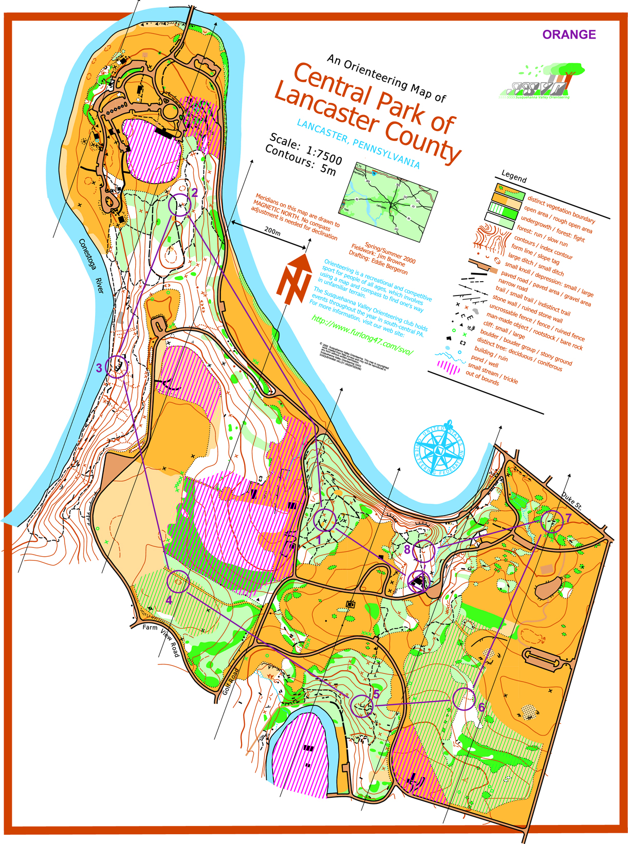
Click the map to see a larger version.
An orienteering map has several colors, each representing different features.
White: Areas of forest/vegetation with good visibility and runability
Green: Areas of forest/vegetation with moderate, poor, or zero visibility and runability. The darker the shade of green, the thicker the forest and the more difficult it is to see and move through.
Blue: Water features such as streams, lakes, and marshes
Brown: The contour lines showing the shape of the land. Other land features such as small knolls, earth banks, pits, and rootstocks (the large root balls of fallen trees). Paved roads and gravel areas are also brown.
Yellow: Open areas with darker yellow being more groomed (such as a mowed lawn) and lighter yellow being more rough (tall grass)
Black: Rock features including boulders and cliffs. Manmade objects like trails, buildings, fences, stone walls, and other miscellaneous objects.
A more detailed overview of the symbols can be found on the map legend.
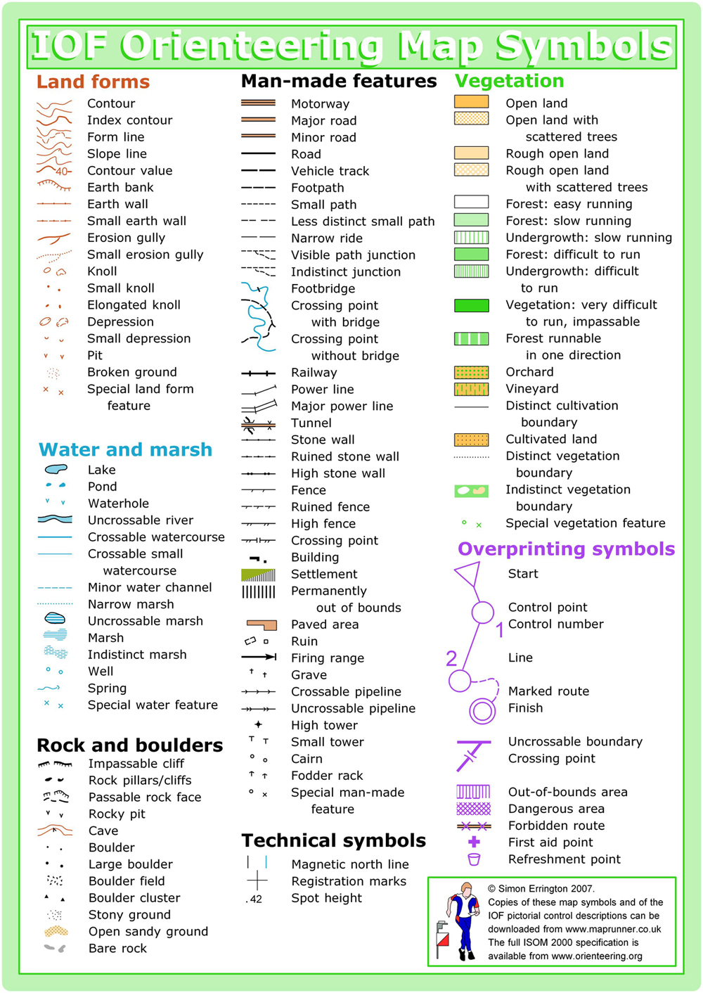
Click the legend to see a larger version.
Now, orient yourself to your surroundings. Look for familiar landmarks like lakes, buildings, clearings, and roads and find them on the map. On a beginners' course, you can easily find your way without a compass, but you can practice using the compass and magnetic north lines on the map to help orient yourself. Follow linear features like trails, streams, or the edge of a field. Keep track of your place on the map as you go. Find the best way to each of the controls. You must do them in order but you do not need to stay on the red lines. That is the strategy to orienteering. Sometimes it may be faster to take a longer route if it is smoother or easier. The choice of the fastest route occupies much of the conversation after the event.