Susquehanna Valley Orienteering
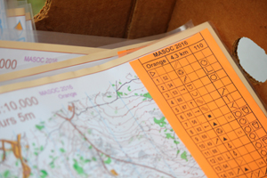
Beginners' Guide: The Clue Sheet
Attached to the map will be a clue sheet (also called control descriptions) to help you pinpoint the control by describing the feature you are looking for. On White and Yellow Courses, the English translation for the symbology will be given. On the Intermediate and Advanced Courses, only the symbols are drawn.
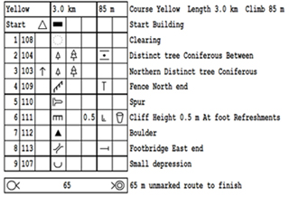
The clue sheet is divided into several columns. The first column tells you the control number on the map (e.g. #2). The second column tells you the control code that will be physically attached to the marker (e.g. 104). This is for the chance that you would happen upon a marker for a different course. The third column tells you which of similar features to look for such as Southern or Middle. The fourth column gives you the specific feature such as a re-entrant (draw/gully), boulder, cliff, dry ditch, or lake. Next comes details about the feature such as shallow, marshy, or rocky. Then the dimensions such as 3 meters tall. Finally, the location of the flag on the feature such as North Side or Southwest Corner, and then other special information such as a water stop or a manned control.